Grand Canyon Backcountry Management Plan and Draft Environmental Impact Statement
Public comments are due by April 4, 2016 at 11:59 pm MST
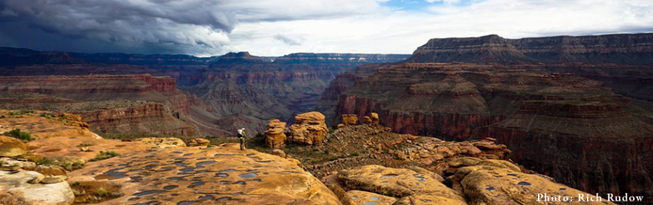
After five years of work, Grand Canyon National Park has released the 628 page Backcountry Management Plan / Draft Environmental Impact Statement (plan/DEIS) for public comment. The last BCMP was released in 1988 and did not address canyoneering. This updated plan considers newer recreational activities, like technical canyoneering.
Technical canyoneering in Grand Canyon NP involves all of the activities usually found when canyoneering in other areas, but there are additional complexities unique to the Grand Canyon. The terrain is generally far more difficult to traverse than other destinations. While day use canyoneering is common in the Marble Canyon area, the big, bold classic slots all require difficult multi-day backpacking access. Many require river-assisted travel (packrafts) to complete routes. A link to the full DEIS and an Executive Summary documents is provided below.
http://parkplanning.nps.gov/document.cfm?parkID=65&projectID=22633&documentID=69426
![]()
INTRODUCTION
This Grand Canyon National Park Backcountry Management Plan / Draft Environmental Impact Statement (plan/DEIS) evaluates the impacts of a range of alternatives for managing backcountry use in Grand Canyon NP in a manner that protects and preserves natural and cultural resources and natural processes and provides a variety of visitor experiences while minimizing conflicts among various users.
This plan/DEIS evaluates the impacts of the no-action alternative (Alternative A) and three action alternatives (Alternatives B, C, and D). Alternative A would allow backcountry use levels to remain similar to current and emerging uses such as canyoneering and extended day hiking and running (rim-to-rim) would not be managed. Under all action alternatives (B, C, and D) an adaptive management process would be used to manage climbing, canyoneering, extended day hiking and running, Tuweep day use, Use Area management and human waste management.
In order to help understand the various elements, the Coalition of American Canyoneers has reviewed the BCMP plan/DEIS and prepared a summary of each area that we feel impacts canyoneering. In general, we support Alternative B (The NPS preferred alternative). However, there are some components of Alternative B that we feel need to be modified.
If you would like to read the full text of CAC’s comments they can be found here:
http://www.americancanyoneers.org/gcnp/bcmp/draft-eis-comments/
Click on any topic above to go directly to that section
![]()
To submit comments go to: https://parkplanning.nps.gov/commentForm.cfm?documentID=69426
A few notes about the process.
1) You are welcome to use CAC’s summary, but if possible, please try to speak from personal experience.
2) State the BCMP plan/DEIS proposal, your concerns, and your suggestion with reasons.
3) You don’t have to submit everything at once. You can make as many separate submissions as needed.
4) Note that the comment period closes on April 4, 2016. Comment & comment often!
Adaptive Management
BCMP/DEIS Proposal: Under alternatives B, C, and D, the NPS will apply Adaptive Management to canyoneering. The application of Adaptive Management is discussed on page 46 of the plan/DEIS. In general, the NPS believes that canyoneering is new and adequate data doesn’t exist to precisely define a regulatory regime. The idea is to observe impacts if they appear in the future, and then define a solution to the impacts based on data collected from monitoring activities. The CAC and the NPS already have an established history of working together using an informal Adaptive Management process. CAC worked with the NPS to define the interim rules and etiquette for canyoneering that were published in the Grand Canyon Technical Canyoneering Bulletin.
Issue: We are concerned that canyoneers and other user groups are not expressly included in the Adaptive Management Process.
CAC Comments: An ongoing dialogue between Park management and interested stakeholders is essential to the long term success of the Backcountry Management Plan. The stakeholders will have additional ideas based on use, can provide labor for services projects, and provide or raise funding to help with solutions.
The final BCMP should provide for systematic stakeholder involvement in the Adaptive Management Process. This could include notification, a comment period, and meetings to reach solutions.
RABT • River-assisted Backcountry Travel (aka packrafts)
BCMP/DEIS Proposal: Under all action alternatives, portable, personal watercraft used on the river for RABT would be carried in and out by the user during the permitted itinerary, max. group size would be 6, resource and visitor use impact monitoring would occur and adjustments made if needed. RABT trip length varies by Alternatives: Alternative B provides 31 specified zones having to do with entry & exit points (pages 57-58), the current is limit 5 miles.
BCMP/DEIS Proposed Rule: RABT trips would be limited to one river section per permitted trip or two river sections if on different days.
Issues:
1) RABT users travel in groups no larger than 6 people and can camp at many small sandbars and ledge camps unsuitable for traditional river trips. As currently formulated, RABT users could camp at large river user camps which could create unnecessary conflicts between user groups.
2) How does the transition between zones work?
CAC Comments:
1) Add language from the Noncommercial River Trip Regulations in regards to camping and visitation restrictions.
https://npspermits.us/grandcanyon/river/pdf/Noncommercial_River_Trip_Regulations.pdf (pages 11-13)
Add language similar to the Grand Canyon River Courtesy Brochure: Smaller groups have advantages and flexibility that larger groups may not have. Camp at sites suited to the size and means of your party. Please be considerate!
2) In order to not concentrate camping at zone transitions, have camping be legal within +/- 1 mile of a zone transition .
BCMP/DEIS Proposed Zone 13: Closed from the Boat Beach to Horn Creek.
Issue:
The closure of Zone 13 from the Boat Beach to Horn Creek makes access to the Trinity Creek slot canyon more difficult. Trinity Creek is a technically easy and scenic slot canyon suitable for intermediate level canyoneers. With the Alternative B Zone 13 closure, legal access to Trinity Creek is by rappelling through Horn Creek with a portage of Horn Creek rapid on river left (technically advanced requiring a run of the Horn Creek tail waves) or a long off trail access route by foot from Phantom Ranch to Trinity Creek.
CAC Comments:
We suggest that Zones 13 and 14 be adjusted. Zone 13 should be closed from the Boat Beach to 1/4 Mile downstream of the Pipe Creek junction with the Colorado River. Zone 14 would then extend from 1/4 Mile downstream of Pipe Creek to Granite. This allows canyoneers to walk on river left around Pipe Creek Rapid then float to 91 Mile Canyon for access to the Tonto level above Trinity Creek. Horn Creek Rapid is easily portaged on river right, but not on river left. Adaptive Management can be used to alter access if this approach comes up short in some way.
BCMP/DEIS Proposed Zones 27 to 31:
Zone 27: Trail (219.5) to Diamond Creek (225.9)
Zone 28: Diamond Creek (225.9) to Bridge Canyon (235.3)
Zone 29: Bridge Canyon (235.3) to Spencer Canyon (246.3)
Zone 30: Spencer Canyon (246.3) to Burnt Spring Canyon (260.0)
Zone 31: Burnt Spring Canyon (260.0) to Park Boundary (277.6)
Issue:
RABT Zones 28 & 29 have river left boundaries and the proposal states: Hualapai Tribal Permit required for access across the Hualapai Reservation. Currently the Hualapai tribe will not permit exits on river left (with the exception of Diamond Creek).
CAC Comments:
We propose alternative zones that allow north rim loop hikes to be completed without needing to exit on Hualapai tribal lands.
Zone 27: Trail to Separation
Zone 28: Separation to Burnt
Zone 29: Burnt to the Park Boundary
Eliminate zones 30 & 31.
Canyoneering Anchors
BCMP/DEIS Proposal: Under all action alternatives (pg. 48, table 2.4), a fixed anchor policy will be implemented (no policy currently exists). Under this proposed policy, authorization would be required for placement of new fixed anchors or equipment, and replacement or removal of existing fixed anchors or equipment.
Issues:
1) “Fixed anchors or equipment” is not defined in the plan/DEIS. We assume that it means permanent fixed anchors, such as bolts. We also assume that canyoneering anchor techniques that employ webbing, wire nuts, cams, fiddle sticks, sand traps, and other removable anchor techniques are allowed as implied by reference to “clean canyoneering techniques” (p. 48, table 2.4).
2) “Authorization required for placement of new fixed anchors” means that any new permanent fixed anchors would require approval from the Grand Canyon NPS before placement. Replacement or removal of existing fixed anchors would also require pre-approval (p. 48, table 2.4).
3) Neither the NPS or the plan/DEIS have defined a process to manage fixed anchors, therefore, we are unable to comment on the viability of the process.
CAC comments:
To avoid confusion, we define a fixed anchor as an anchor that is left in place after use. We also make a distinction between removable fixed anchors that do not alter rock surfaces (e.g. slung chockstone or vegetation) and permanent fixed anchors that require alteration of the rock where the placement is to occur (e.g. bolt or piton, see BLM memo).
With regard to authorization for placement of new permanent fixed anchors, we propose that Grand Canyon NPS take a programmatic approach, as provided in Director’s Order #41, p. 15-16: Authorization may be issued programmatically within the Wilderness Stewardship Plan or other activity-level plan, or specifically on a case-by-case basis, such as through a permit system.
An example of a programmatic approach is the anchor policy in use at ZION NP, which has been in place since 2007 and is working well. We suggest that the Grand Canyon NPS programmatically authorize canyoneers to place and remove permanent and removable fixed anchors, with a strong emphasis on clean canyoneering techniques and practices. Likewise, the BCMP should define a process for making park-level decisions regarding the placement or removal of fixed anchors. CAC would be happy to collaborate on creating the process, educating canyoneers about the process, and assisting in fixed anchor placement or removal if required.
Issue:
There is no proposal in the plan/DEIS concerning the rule of using only black webbing for fixed anchors as proposed in the Grand Canyon Technical Canyoneering Bulletin.
CAC comments:
The black webbing rule should be included in the canyoneering anchor policy. Climbers and canyoneers have been asked to use “color matched” webbing for a long time, without much success. Other colors can work in some places, but black always works due to the universal presence of shadows, cracks, mineral streaks and other black features, independent of rock color. This simpler, more specific approach has a greater chance of success than the traditional color-matching plan.
Deer Creek Narrows
Background: The lower Deer Creek narrows beginning at the southeast end of the rock ledges known as the Patio, was closed by Superintendent Compendium order in April of 2012 at the request of Indian tribes affiliated with Grand Canyon. CAC and other user groups protested the closure on the grounds that the lawful public participation in a controversial closer did not occur. The Grand Canyon NPS subsequently agreed to a temporary closure with the opportunity for the public to comment in the Backcountry Management Plan process.
BCMP/DEIS Proposal: Alternative B closes the lower Deer Creek narrows permanently, while Alternative C in the plan/DEIS opens Deer Creek to canyoneering descents.
Issues:
The closure of the Deer Creek narrows was unlawful. The affiliated tribes identified many issues with Deer Creek visitation that are not addressed by the closure of the Deer Creek narrows. We strongly support the right of the tribes to visit Deer Creek in a quiet and respectful environment. In the plan/DEIS chapter 4, environmental consequences for Alternative C, a series of impacts are described to occur when canyoneers enter the Deer Creek narrows. There is no data to support these impacts and frequent violent flash floods would erase any impacts if they did actually occur. The NPS faced a similar conflict between tribal beliefs and recreational users at Devil’s Tower NM and resolved the issue with nuance and compromise. No effort was made by the Grand Canyon NPS to explore similar solutions.
CAC Comments:
We believe that the greater Deer Creek area should be closed, not just the narrows, to allow the tribes to practice their religious beliefs. These closures should be of short duration and scheduled to coincide with tribal visits (i.e. times when the tribes are physically at Deer Creek). Outside of these tribal visits, technical descents of Deer Creek narrows to the river should be fully allowed. Adaptive Management should be used, with stakeholder input, to design the best compromise between the tribes and the recreational community.
Great Thumb Mesa & Tenderfoot Rim Access
Background: President Ford signed the Grand Canyon NP Enlargement Act in 1975. This law nearly doubled the size of Grand Canyon NP and also appropriated a Havasupai Reservation addition of 185,000 acres. Additionally, the Havasupai obtained the right to use 95,300 acres of the National Park as a traditional use area. The additional reservation lands included Great Thumb Mesa and Tenderfoot Rim, effectively blocking access to the National Park between Forster Canyon on the east and National Canyon on the west. In order to ensure that development of rim areas could not occur, the Act maintained a ¼ mile setback from the rim around Great Thumb and Tenderfoot Rim as National Park lands. The Act required recreational user access to NP lands across the newly established reservation lands. The Secretary of the Interior, in consultation with the Havasupai Tribe, was ordered to define the access mechanics. In March of 1982 the Secretary Land Use Plan was published, but never implemented.
BCMP/DEIS Proposal: The Grand Canyon NPS would work the Havasupai Tribe on pilot program to permit ten small groups (1-6 people) across Great Thumb Mesa to the park’s backcountry from March to May. Permit conditions include: tribal escort, two vehicle maximum, four-wheel drive/high-clearance, and assigned parking.
Issues:
Because the 1982 Plan was never implemented, Havasupai tribal representatives routinely deny access to the public contrary to the law. The Department of Interior abandoned its authority granted under the Act to monitor and ensure implementation of the plan, again contrary to the law. The 1982 Plan provides just two methods of access off Great Thumb – Apache Point and Great Thumb Deer Trail. The Havasupai did not have veto power over access routes. Other routes off Great Thumb were well known and used by backpackers prior to the Act.
The Act clearly included Tenderfoot Rim, the rim lands between Havasu Canyon and National Canyon, for recreational public access. The 1982 Plan did not provide means for public access across Tenderfoot Rim, again deferring to the Tribal view that no suitable access existed. Backpackers and climbers had been using various access points off Tenderfoot Rim prior to the passage of the Act. The Act in no way contained such restrictions on the level of access as proposed.
CAC Comments:
Grand Canyon backcountry use areas BS9 and BT9 envelope Great Thumb Mesa and are quite large. Access across Great Thumb Mesa reservation lands is essential to reach key destinations within these use areas including 11 slot canyons. We suggest access off the rim of Great Thumb be allowed at the following places: Apache Point, Enfilade Point, the Cave route near the head of Fossil Canyon, The Owl Eyes route near the tip of Great Thumb, the Old Deer trail to 140 Mile Canyon, the 140 Mile Canyon slide route, the route between Hamidreek and Gatagama points, the Paya Point route, and the Towago Point route. A map can be found here: http://www.trimbleoutdoors.com/ViewTrip/808376
Grand Canyon backcountry use area BU9 is quite large encompassing all of Yumtheska Mesa and the eastside of National Canyon. Access across Tenderfoot Rim is essential to access 8 slot canyons. We suggest access off the rim of Tenderfoot Rim at the following places: the 2-203 route, the 5909 route, the Flatiron Butte route, the Tenderfoot Route, and the Yumtheska Point route. A map can be found here: http://www.trimbleoutdoors.com/ViewTrip/808376
We believe that 10 permits per year in the spring will be insufficient for the projected permit demand. Currently the resources in BS9, BT9, and BU9 can support two groups of 6 hikers at a time suggesting a substantially larger volume of recreational users needing to cross reservation lands to enter the Park. We suggest that Adaptive Management be applied, with input from the stakeholder groups, to increase the number of permits if demand dictates.
Boundary Road
BCMP/DEIS Proposal: Boundary Road on the South Rim provides an alternative access to the South Bass Trail Head. Alternative C indicates that opening the boundary road will cause environmental damage resulting from road maintenance. Alternative B, the preferred alternative, keeps boundary road closed.
CAC Comments:
Boundary road should be opened and NOT maintained. There are plenty of other roads in the Grand Canyon NP system that are handled this way. There is no reason to maintain the road. The road across Havasupai lands and from Havasupai lands to South Bass are not maintained. Boundary provides alternative access to South Bass for suitable bicycles and vehicles.
Canyoneering Itinerary Requirement
BCMP/DEIS Proposal: The plan/DEIS requires a disclosure if technical canyoneering is part of an itinerary and it requires the specific route to be disclosed. These disclosures are supposed to be for information purposes only.
Issues:
The Grand Canyon permits office is currently “red flagging” any permit where the canyoneering or packrafting check boxes are marked. This red flag then automatically requires the permittee to disclose the route on a Hiker Information Sheet (HIS). Too often CAC members are having permits refused because permit office staff are unfamiliar with the route(s) requiring substantial interaction to clear up the misunderstandings.
The intention of this plan/draft DEIS rule is unclear. What will the information be used for? Is the NPS assuming the responsibility of a safety contact for the permittee group? Is the information used to increase scrutiny of the canyoneering user group? Is the information used to understand resource impacts and how to potentially mitigate those impacts?
Canyoneering itineraries can vary substantially from the original plan while still adhering to the camping permit use area. Groups may move slower through canyons due to new obstacles or may move faster with high experience levels. It’s common for canyon technical descents to be abandoned due to the condition of the group after the rim entry or the weather situation before the technical descent begins. What happens if canyoneers don’t precisely do what they intended when filling out the permit form?
We encourage groups to have an emergency contact with a detailed itinerary and plan. Some may have a means of communication with the emergency contact to check in at appropriate points on the itinerary. If the group misses a check in, the emergency contact can call the NPS with the detailed plan and any deviations from the plan that occurred in the field. We don’t believe the NPS wants the responsibility, or has the manpower, to take on this responsibility directly.
CAC Comments:
We support the collection of itinerary data to better understand resource impacts and to make better decisions to mitigate those impacts as part of Adaptive Management. We do not support the collection of itinerary data for any other reason. Most canyoneering occurs in Wild and Primitive use areas where there is a substantial expectation of solitude. The use areas are very large to allow people to roam and to preserve this important Wilderness value. The notion of providing a detailed step by step itinerary flies in the face of this principle.
Because canyoneering itineraries can change in the field, we suggest a monitoring system that collects the actual canyoneering itinerary after the trip has completed using an online system. Death Valley National Park has proposed this in their Wilderness Plan. We believe that more accurate data will be collected after the fact and we support the Death Valley approach.
Commercial Filming
BCMP/DEIS Proposal: The essence of Alternatives B, C, & D is to limit filming in the Grand Canyon NP. In particular commercial filming would not be allowed in the Wild Zone. Alternative B calls for the purpose of filming to meet a necessary and appropriate Wilderness test, no commericial activity in the Wild Zone, and wilderness commercial filming requests evaluated under a minimum requirement analysis.
Issue:
Throughout the Backcountry Plan, there is reference to the term market audience. However, this term is not specifically defined in the various documents cited above. It is possible that individual backcountry users on permit in the Wild Zone might take still photographs or video using relatively small cameras. These images might find their way into websites that ultimately could generate a profit to its owner via internet advertising clicks. The photographer might be found in violation of: “Filming that involves digital or film recording of a visual image or sound by a person, business, or other entity for a market audience (Management Policies 8.6.2.2).”
CAC Comments:
We believe that images of all zones in the Park should be shared with the world. This is already in accordance with Public Law 106-206 as noted in the NPS Management Policies 2006 for still photographs. Thus, currently it is legal to take a still photograph with a smartphone but a video on that same phone would be illegal. The CAC requests that the regulation be reworded such that still images and video be treated in the same manner. Obtaining and sharing these images in all Park Zones would be allowed.
The CAC recognizes that there is a significant difference between the impact of a group of six backcountry users using small photographic equipment and that of a large traditional film crew. We appreciate that the latter could have a substantial impact on the backcountry and hence should be regulated. Technology has advanced, such that individuals now can personally accomplish what large groups were required to do in the past. We believe that the terminology “market audience” is at the heart of this discussion. Consequently we ask that the Park either fully define market audience or cease use of the term. Further, we request that a concrete distinction be made with regard to a small permitted group using personal camera equipment vs. a large scale film production company.
Dividing Boysag Use Area (LB9)
BCMP/DEIS Proposal: This has not been addressed in the plan/DEIS, although it was requested in the public scoping prior to the plans release.
Issue:
Use area LB9 in the western Grand Canyon is excessively large. Canyoneers and hikers in Mile 150 Canyon can be blocked from access by canyoneers and hikers in Tuckup Canyon 14 river miles away. The chance of overlapping in the current use area is practically zero. This can also create a safety issue in that canyoneers descending 150 Canyon may try to get through the entire canyon and across the river in one day to avoid needing a permit to camp in LB9 when it would be safer to allow more time and camp within the canyon.
CAC Comments:
We propose that LB9 be broken into two use areas with the new boundary at Cork Spring Canyon. We propose that both use areas be designated Wild. This is especially important now that only two groups of 6 are allowed in Wild use areas.
River Zone/Human Waste Disposal
BCMP/DEIS Proposal: The plan/DEIS proposes to adopt the River Zone identified in the 2006 Colorado River Management Plan. The River Zone is from the shoreline along the Colorado River up to the historical high-water line. It would include beach campsites such as Granite, Hermit, Hance Rapid, and South Canyon. Under all action alternatives the new plan will require human waste to be carried out from River Zone. The Human Waste policy will be subject to Adaptive Management, with possible future actions to include replacing or removing existing toilets, installing toilets at additional sites, or a year-round waste carry-out requirement at all, or specified, use areas or zones.
Issues:
There is no clear definition of the exact areas to be considered, nor is it clear if this would include the area (trails or routes) between selected beaches. In addition, there is no language that dictates that you wouldn’t be able to camp along the river, yet go above the high water zone and dig a cat-hole. Specific to Hance Rapid, there is a documented problem with damage to the dunes behind the beach. Extensive social trailing is evident and is undoubtedly made worse by efforts to use or cross the area in search of suitable toilet locations. Since this dune area falls outside the River Zone, we are concerned that the recommended policy will not protect the area.
CAC Comments:
1) Define the areas to be considered on implementation of the BCMP and clarify the issue with travel.
2) CAC supports the policy that any camping within the River Zone should require that human waste be carried out of the canyon and properly disposed of (Wag Bags or similar systems). If you are camped in a River Zone, it would be illegal to hike above the high-water mark and dig a cat-hole. This requirement should not extend to hiking within the River Zone, but contain language to discourage human waste deposits in concentrated areas.
Thank you for your time and effort!