UPDATE – Marble Canyon Closure • 9/3/19
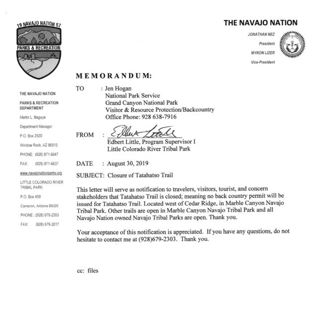
The Navajo Nation released an update to the recent closure of access to Marble Canyon via Navajo reservation lands. The closure now only affects the access to the Tatahatso Point area. Permits for all other areas are being issued by the Navajo Tribal Park. Please respect the closure of the Tatahatso Point area and do not travel on other Marble Canyon reservation lands without a permit. Doing so jeopardizes future access.
NOTE: Even though the letter says “Trail” it means the road to Tatahatso Point which effectively closes access across reservation land to Tatahatso Canyon, Tatahoysa Canyon & the Eminence Break Route. The technical canyons lie within Grand Canyon National Park and remain open and accessible by alternative routes.

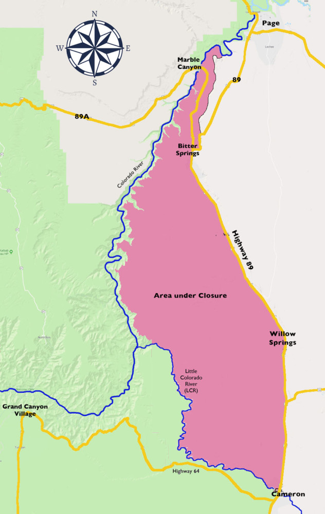
Navajo Nation Closes Access to Marble Canyon
The Navajo Nation has closed all access to Marble Canyon via Navajo reservation lands. This closure affects access to many popular slot canyons. The Coalition of American Canyoneers is actively working with the Navajo Nation to determine if access can be reopened. Note: This closure does not affect access to Waterholes Canyon.
This closure reportedly came about because the Bodaway-Gap chapter felt visitors to tribal lands were often not obtaining permits, were starting illegal campfires, were often getting stuck on rough roads requiring rescue, and were not generally treating the land the way they felt it should be treated. As a reminder, we’re almost always recreating on lands managed by others and it’s imperative that the land manager rules be followed to ensure continued access. We urge the canyoneering community to honor the Navajo closure and to avoid travel on Navajo Lands around Marble Canyon.
The National Park Service has indicated that the use areas in Marble Canyon beneath the rim within the Park east of the river (SF9, SG9, SH9, SI9) remain open for permits, however, access to these use areas must be from BLM lands on the west side of Marble Canyon using a packraft to cross the river to access the east side use areas. A National Park Service permit could be denied if Navajo lands are being used to access these use areas. Routes off the western rim of Marble Canyon create terrific loops to access east side slot canyons but these routes are often rugged and convoluted compared to access via Navajo Lands. Be accordingly prepared if attempting these routes.
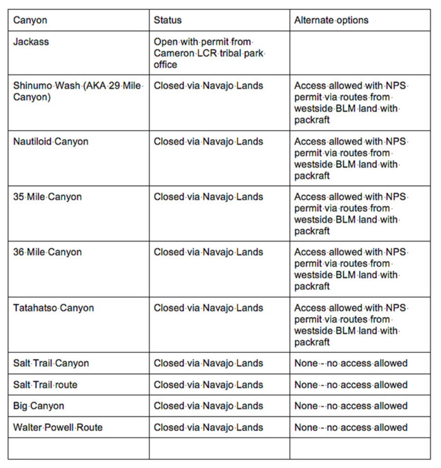
The following table lists the affected canyons and if alternate access is available:

For Jackass Canyon permits the Cameron LCR Tribal Park office is located on the corner of Hwy 89 and Hwy 64 on the southwest corner. 928-679-2303

